








OCT 27 | 4:00 PM

All auctions / Books, Maps & Manuscripts / CARTE MÉTÉOROLOGIQUE AVEC PLAN DE VOL MANUSCRIT AYANT APPARTENU À

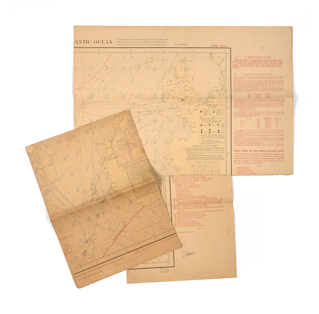
CARTE MÉTÉOROLOGIQUE AVEC PLAN DE VOL MANUSCRIT AYANT APPARTENU À JEAN MERMOZ, DATÉE JUIN 1929 Fond de carte imprimé sur papier et légendé : “PILOT CHART OF THE NORTH ATLANTIC OCEAN / By the Hydrographic office of the Navy Department, Washington, D.C.” [Fondée sur les recherches établies au début du XIXe siècle par Matthew Fontaine Maury, lieutenant de l’US Navy] Portant des annotations manuscrites : tracé d’une ligne partant de la « V.(illa) Cisneros », « pointe du pêcheur » jusqu’à Cap St Roc, en passant par les îles du Cap Vert annotées « Sault », « Fego » et « Santiago ». Une seconde ligne partant de Saint Louis et allant jusqu’à Natal situe « Becfigue », « Phocée », « Bemtivi » et « Cigogne » les différents avisos de la Compagnie qui stationnaient au large et pouvaient porter secours à un avion en détresse le cas échéant. 33 x 24 cm (Papier insolé, pliures, salissures, déchirures éparses) A weather map with handwritten flight plan, formerly belonging to Jean Mermoz, dated June 1929
Estimate:$225.04
To the auctionView all items fromArtcurialorBooks, Maps & Manuscripts
Estimate:
$225.04


OSCAR WILDE, "Salome", tragedi i akt med 16 teckningar av Aubrey Beardsley
10/13/2026
$85.39
Est: $99.62

OCT 27 | 4:00 PM


OCT 23 | 8:00 AM


OCT 17 | 10:00 PM
Bring your auction to collectors worldwide!
Get listed nowBy subscribing, you are agreeing to the privacy policy. Unsubscribe anytime.
Barnebys HQ
Brahegatan 10
BOX 5038
114 37 Stockholm
